
 Interspect
Interspect Ltd.
Photogrammetry, Remote Sensing, and Environmental Conservation Company
Contact Us
Phone: +36 70 615 7223
Email: info@interspect.hu
Website: www.interspect.hu
Company Details
Company Name: Interspect Ltd.
Company Registration Number: 13-09-133715
Tax Identification Number: 11690571-2-13
EU VAT Number: HU 11690571
Statistical Code: 11690571 2651 113 13
Unmanned Aircraft System (UAS) Operator Registration Number: HUNlk5z5tznao3eg
Bank Account Number: 10918001-00000090-22710009
IBAN: HU81 1091 8001 0000 0090 2271 0009
SWIFT: BACXHUHB
Date of Registration: 10 December 2009
Websites: www.interspect.hu, www.interspect.net
Email Addresses: info@interspect.hu
Mailing Address: 2314 Halásztelek, II. Rákóczi Ferenc út 42., Hungary
Phone Number: +36 70 615 7223
About Us
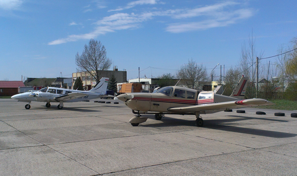
The Interspect Group was founded to provide Earth observation, aerial remote sensing and land cover data to municipalities, commercial enterprises, nature conservation agencies, ecologists, and environmental assessment organizations—completely independent of any specific trend, instrument ecosystem, or environmental evaluation fad. Accordingly, our company primarily generates spatial data for environmental protection, urban planning, engineering, nature conservation, and landscape ecology projects: References. In addition to producing orthophotos and 3D surface models, our activities encompass the design and manufacturing of aerial camera systems for high-resolution aerial mapping, technical research and development, system calibration, and the distribution of photogrammetric software. Starting in 2009, our proprietary aerial photography method—which delivered approximately sixteen times higher resolution than conventional solutions at the time—attracted international attention and rapidly became the benchmark for quality in Hungarian orthophoto production. The core advantage of our technology lies in spatial resolution ranging from 0.5 to 20 cm, exceptional image quality, rapid project execution, and client-tailored flight planning. We perfected our high-density, high-precision aerial imaging methodology with minimized atmospheric attenuation in 2008 and first presented it at the 14th European Energy and Environment Conference. Its practical significance has since been undeniable; driven by similar industry demands worldwide, this approach has gained global adoption and opened new horizons in scientific and cartographic aerial photography and data interpretation. Utilizing our continuously evolving sensor payloads, it is possible to economically map increasingly large surface areas at map scales ranging from 1:100 to 1:12,000. We take pride in the fact that our research team was the first Hungarian enterprise to achieve and make commercially available a centimeter-level Ground Sample Distance using fixed-wing aircraft. This represents a breakthrough in aerial photogrammetry and image analysis, particularly as it enables the generation of multispectral orthophotos with a 0.5 cm GSD from images acquired by high-speed aircraft. Numerous sectors benefit from this enhanced information content. Our orthophoto maps are applied not only for monitoring urban development, detecting unauthorized construction and illegal dumpsites, and evaluating vegetation dynamics, but also in habitat mapping for endangered species, inland flood mapping, and various other scientific research projects. We have deployed our high-resolution multispectral acquisition workflows alongside 498-channel hyperspectral systems and airborne LiDAR equipment; however, our orthophoto services and surface models remain our most frequently requested deliverables. Beyond engineering, cartographic, and reconstruction applications, our high-resolution aerial maps and perspective visualization imagery have also proven highly effective for marketing purposes (web platforms, billboards, advertising, and publications).
Business Policy
In every project, we strive to recommend the optimal methodology to our partners so they can efficiently leverage the full advantages of aerial surveying. A key priority is delivering cost-effective solutions to client requirements—providing rigorous, high-information-content, and reliable spatial data using the most economical technology that fully and safely meets project requirements. To this end, we engage in continuous professional development, rigorously benchmark cutting-edge hardware, rapidly integrate and mature new methodologies, and implement state-of-the-art processing algorithms.
Acquired spatial data are maintained in our long-term archive, which we actively manage and make widely accessible through our webstore platform.
Alongside client communication, we place strong emphasis on quality control, internal evaluation, and systematic client feedback regarding our products and services.
Leadership of the Interspect Group

Gábor Bakó
Managing and Scientific Director, Engineer-Biologist, Remote Sensing Specialist, Forensic Expert
Zsolt Molnár
Managing and Technical Director, Photogrammetry Specialist, Software Engineer


András Arday
Chief Pilot, Flight Operations Manager, Precision Flight Controller
Email: ardayandras@interspect.hu

Public-Benefit Environmental, Restoration, and Archival Programs
- Surveying landscape scars, open-pit mines, quarry lakes, landfills, and other microclimate-altering features
- Mapping the spread of environmentally harmful plants (invasive, allergenic, and soil-altering species)
- Protection and restoration of steppe oak forests
- Assessing the long-term impacts of the Ajka red mud disaster
- Digitization of Hungarian historical aerial photography archives